Thursday, December 27, 2018

Niue - A Tiny Island Nation

(Sylvia)

We are in New Zealand but will be posting some catch-up info about our journey from French Poly to New Zealand. We've already done posts on Legs 1 and 2.

Moving West: 
Leg 1 Raiatea, French Polynesia to Palmerston, Cook Is. (Sept 23-28), 675 nm
Leg 2 To Beveridge Reef (Oct 5-7), 288 nm
Leg 3 To Niue (Oct 8-9),             142 nm

Leg 4 To Vavau, Tonga (Oct 12-14) 245 nm
Leg 5 To Nuku'alofa, Tonga (Oct 31-Nov 1) 168 nm
Leg 6 To Minerva Reef (Nov 7-8)     258 nm
Leg 7 To Opua,  New Zealand, (Nov 10-14) 787 nm
Total                                           2563 nm 


Niue is a tiny, independent island nation located in the triangle between Samoa, The Cook Islands and Tonga. Niue, a raised coral atoll approximately 100 square miles in size, is a self-governing state in free association with New Zealand. Most of its diplomatic relations are conducted by New Zealand on its behalf. Niueans are New Zealand citizens and their currency is the NZ dollar. Many Niueans speak English although they have their own Polynesian-based language.

The first European to sight Niue was Captain Cook. He called the island "The Savage Island" because, as legend has it, the natives who "greeted" him had mouths that appeared to be smeared in blood. The substance on their teeth was actually hulahula, a native red banana. In short, Captain Cook was scared away by bananas. The Niueans were fine with that although in more modern times they didn't particularly care for being called The Savage Island. The name Niue means "Behold the coconut". 


Today they are not that sensitive about being The Savage Island as it makes for good marketing.

Niue faces a problem that many of the islands in the South Pacific are dealing with, dwindling populations (now only about 1600 persons). Most young people have to go to university in other countries such as New Zealand. Once they get used to the modern life of abundance many of them don't return permanently to their island nation. In fact, 95% of Niue's population live in NZ. Niue has implemented an interesting policy because of this. They have opened their island to anyone who wishes to live there, especially people on islands in danger of disappearing due to global warming, such as Kiribati.

Nevertheless, Niue does have a good tourist industry including snorkeling, diving, whale watching, deep sea fishing, hiking and biking, caving, golfing and more. There are (a whopping!) 2 plane flights a week from Auckland, NZ).

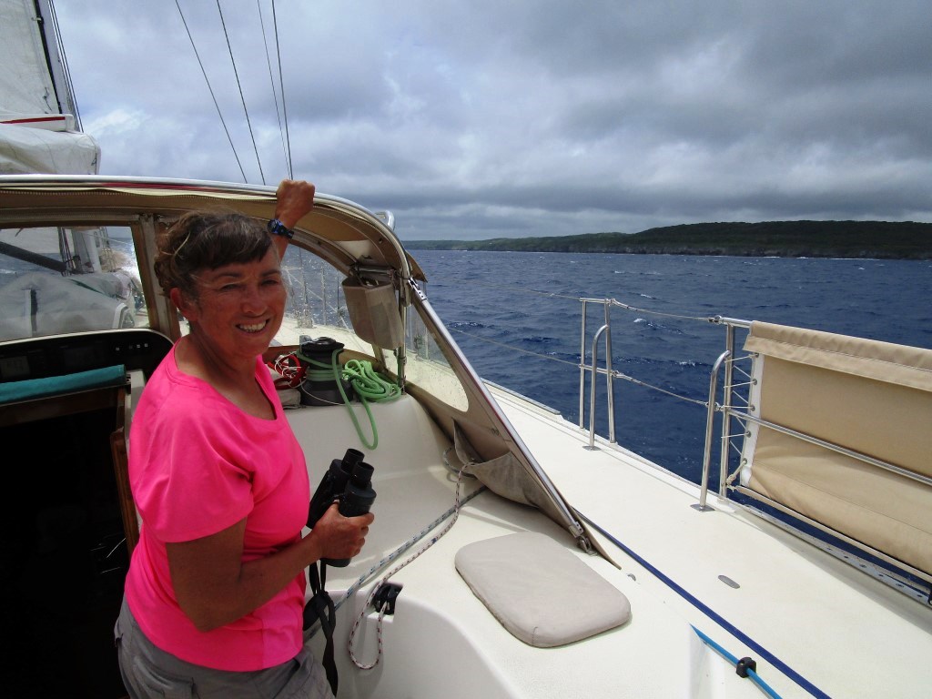
We left Beveridge Reef for Niue with our buddy boat Y2K and had a fairly uneventful overnight trip (148 nm) to Niue. We mostly had good wind, the seas weren't too bad, just an occasional big swell, minimal drama (except for a flying fish that ricocheted off Sylvia's head), and we arrived at Niue the next afternoon accompanied by dolphins and whales on a cloudy day. 

Land Ho!! Niue!

When we arrived in Niue we were with several other boats who had sailed there from Palmerston. We were very happy to see our friends Mick and Isabel on ONDULAR (Aussie and Ecuadorian, they are heading to Australia), Oskar and Lisa on HILMA (Swedish, they are heading north to Micronesia), and of course Y2K who journeyed with us from Beveridge Reef and will continue on to New Zealand. All the other boats who had been with us in Palmerston had bypassed Beveridge and Niue to go directly to Tonga. 

Niue currently has a terrific mooring field (~17 moorings) which is a good thing because there is no place to drop an anchor unless you are prepared to anchor in VERY DEEP water (>60 ft) with a rocky coral bottom. The moorings are in an open roadstead and are some of the best in the south pacific because they are regularly maintained by the tiny Niue Yacht Club (https://nyc.nu/). Without the solid moorings, it would be much more difficult and risky to visit this place.


Cinnabar on her mooring in 60'.
Clear water, abundant coral and fish make for good snorkeling (nearer to shore).

After grabbing our mooring we dinghied in to shore to check in with customs. The concrete dock is high up so one of us (Sylvia) had to get off, climb up some slippery concrete stairs, and use a small boat crane to hoist the dinghy up onto the pier. (there are no beach landings - the island is surrounded by a cement-like coral rock apron).


We approach the dinghy dock and crane. Hmmm...

Actually it was no problem and they even had a hand trolley for moving the dinghy into a parking spot after hoisting. It might appear somewhat questionable, but this hoist system is quite ingenious, works pretty well, and is rather fun to negotiate.  

The day after we arrived we got a radio call from Max on Y2K. It was his birthday and he invited all of us to rendezvous that afternoon for drinks and dinner at one of the local restaurants. This was pretty much the same group that had dined together with Edward on Palmerston so it was a good excuse for a reunion. 


Alex from Y2K operates the dinghy hoist. (photo by Y2K)


Max's party with Max not in the picture! L to R Oskar and Lisa, Isa and Mick, Sylvia, Alex and Tom. (Photo by Y2K)


Not the same day but a good photo of Max (and Alex who reached their halfway-around-the-world point during their sail to Niue. Photo by Y2K)

After spending the evening celebrating we returned to our dinghies only to find that the swell had swung to the north and we were getting some healthy wraparound swell combined with an incoming tide which made boarding our dinghies quite challenging. 


Mick checks out the swell crashing against the concrete while we lower Hilma's dinghy.
(note the "best dock light" in all of Polynesia!)


Quick! Get in before the swell crashes you into the concrete!!


Nevertheless we all made it aboard and managed to get back safely to our boats. Whew!!

The next day, we rented a car with Mick and Isabel and toured around the island. Niue has very a dramatic coastline and numerous hiking "tracks", caves, caverns, and grottos which make for fun exploring.


We hike along the rugged Niue coastline.


Going down into the cavern.
Very impressive stalactite/stalagmite formation.


We snorkeled in the crystal clear grotto.
Beautiful coast and wacky tourists.

We'd heard about a crazy Sculpture Park on the island and decided to check it out. The Hikulagi Sculpture Park was established in 1997 by some local artists as a platform to create large format sculpture that discuss environmental issues with the idea that an island is a microcosm of the world. 


The sculptures use a lot of "found" materials, i.e. what was trash, and recycle it into art.


A good use of the plastic that had littered the beach.


A feature of the park is the Protean Habitat which invites visitors to leave their mark on Niue by adding to the sculpture. 


I don't think we added anything but we did pick a few things off the ground and re-installed them.

We felt there was much more to do on Niue (so we might return someday), but that wraparound swell from the north was making our anchorage uncomfortably bouncy. We bounced in Palmerston, we bounced in Beveridge, and now we were bouncing in Niue? No more bounce!! We checked the weather and decided it was a good weather window to head to northern Tonga. We said goodbye to Mick and Isa on ONDULAR, hoping to see them in Tonga, also goodbye to HILMA knowing it was unlikely we would cross paths again, and left with Y2K bound for the Vava'u group in Tonga.


Leg 3 Trip Totals:
Distance sailed  = 148 nautical miles  (Beveridge to Niue)
Duration           = 22.0 hrs.
Avg speed         = 6.5 kts. 
Motored            = 3.2 hrs.


PHOTO ALBUM : BEVERIDGE REEF AND NIUE


Saturday, November 24, 2018

Look Right First - Cinnabar's In New Zealand!


(Sylvia)
We can't believe it's been exactly one month since our last update. The past month has been super busy and we promise we'll do some more thorough updates soon. Much has happened since we left Beveridge Reef bound for Niue and Tonga.

When we finally made it to Southern Tonga we rendezvoused with our incredible and talented crew who had flown in from California via New Zealand. 


Just off the plane, Judy, Torben, Phil (and Sylvia) enjoying the local Tiki Beer in Tonga.


We were very lucky to recruit sailing friends Judy and Torben (who are currently in the Caribbean cruising their Beneteau TIVOLI) and Phil, Express 27 racer from the SF Bay Area who has sailed several passages with Judy and Torben.

In short, we had a fabulous sail from Nuku Alofa, Tonga to New Zealand. I was a bit worried because my cold-weather sailing shoes and boots had become destroyed in the tropical weather. The soles were either slick-hard or permanently gooey, ick. But our weather window for the journey was so pleasant that we mostly went barefoot and Tevas with socks were more than adequate for the coolest times.


Judy geared up for the cool weather, still barefoot.
Sylvia's ready for early a.m. watch.

After a terrific passage (one which is notorious for being very challenging) including a short stop at Northern Minerva Reef (more about that later) we arrived in Opua, NZ to check into the country.


Cinnabar and crew on the Q (quarantine) dock waiting to get visited by Customs.
After checking in we journeyed south to the town of Whangarei (pronounced Fong-ah-ray) which will be our home base for the time being.

We absolutely love what we've seen of NZ so far and we look forward to exploring more of the country. The hardest thing has been to remember to Look Right First before crossing the street. Look right, THEN look left because here in NZ people drive on the left side of the street. 


The crew (in crew t-shirts) at Cinnabar's new "home" in Whangarei, New Zealand. We made it!!!


Coming up: Niue, Tonga, Passage to NZ, Pictures.


Thursday, October 25, 2018

Beveridge Reef - A Submerged, Hidden Mountain Stopover


Can you see the breakers in the distance?

  Can you imagine stopping in the middle of the ocean and dropping your anchor for the night? Well, it is possible if there is a submerged reef/atoll out there with an entrance pass into a shallow-enough lagoon. Beveridge Reef, actually a submerged mountain, is such a place. It is located between Palmerston Atoll and Niue Island and makes for a convenient and intriguing stopping place, IF conditions allow.

Beveridge Reef has a mysterious allure. It rises up directly from the sea floor, 16,000 ft below. It is hard to see (i.e., lies all underwater; there is no land) and wild (no people). Its location is ambiguously charted ("reported to lie 3 miles NE of shown position" - what?! Google Earth satellite imagery shows just a vague smudge). Cruisers often have to abandon their attempts to visit the awash atoll because the weather is frequently stormy here. It lies in the So. Pacific Convergence Zone (SPCZ) region which carries frequent overcast/windy/rainy/swell/nasty conditions. There are a couple of reported shipwreck remains here. 

With hopeful anticipation and and a promising weather window, three of the boats that departed Palmerston decided to aim for a stop at Beveridge and to wait out a predicted 24 hr. windless period. CINNABAR, Y2K (with Italians Max and Alex), and FREYA (with Texan Lewis and South African Jules) all converged at Beveridge within hours of each other, in calm, sunny conditions. As we approached the general area, we gave our  reported GPS waypoints a wide berth until we could actually see breakers in the distance. At about 4 nm away, the white breaking waves, the light blue under-clouds that reflected the shallow water in the reef, and a catamaran at anchor within, showed us exactly where Beveridge was. The catamaran assured us on the VHF radio that as we approached the reef, we would be able to see and readily negotiate the pass through the hidden reef.

After lining up on the pass (using the waypoints given in the above cruising website link) and with a big dose of faith, we increased engine power, monitored our instruments, maintained a keen watch of the sea ahead, and cautiously crept our way forward through the shoaling depths of entrance and finally into the sizable lagoon.


I'm wearing my polarized sunglasses to help identify the shallow spots (and a wireless mic/headset). The pass entrance is dead ahead with breakers to the left and to the right. We saw 24 ft of depth at one point, which is quite shallow. There was 4 knots of ebbing current flushing out the pass against a modest long period (2 meter, 14 sec) SW swell rolling in the pass, on the western side.
At one point, we became a little unnerved as it first appeared as if there was no gap at all in the waves breaking ahead. Where is the so-called pass? But then, as we got closer, we saw a gap of flat water in the near distance.  The waves that initially appeared to be breaking across the pass were actually an optical illusion from the waves on the far distance shoreline, way across the opposite side of the lagoon. Whew - ok - got it.

FREYA followed us right in through the moderately turbulent waters.
Looking WNW from a drone's eye view, the pass is very obvious. Not so much when at sea level.
(all drone pics are courtesy of Max on Y2K)

Once inside it was flat and calm and blue, blue, blue. And silent. And full of a kind of mana (spirit). We idled around the inside periphery of this ocean 'lake', sounding the depths for a while, and spying one of the shipwrecks. We found that the entire lagoon has a depth of about 30-40 feet, and a sandy bottom with only scattered low coral heads, making for good anchoring. After selecting a spot on the SE corner, we dropped anchor and fully relaxed. It was noon time and a beautifully bright and sunny day. We first made a trip to the top of the mast to take some pictures, and then enjoyed an exploration snorkel in the severely clear water.


View of CINNABAR from the top of the mast.
Y2K (closer) and CINNABAR (farther) from the drone, looking north.

Y2K (closer boat) and FREYA anchored nearby. It is open ocean on the other side of the breakers.
Underwater, as expected, it was a broad sandy plain interrupted by sporadic, random rocky bommies harboring the usual small reef fish varieties as expected. There were some sting rays, hordes of hermit crabs, and a 5' shark of some unidentified 'serious' variety that shadowed us the whole time we were in the water. What makes the place special is the pristine wild condition, it's lack of human impact, it's enormous remoteness, the sea life's surprising lack of wariness, and just the striking play of bright sunlight in the clear water on the shallow white sandy bottomscape canvass. Together with the infinite forms of blue hues all around, it was simply one of those mesmerizing experiences.  We swam around in a sort of hypnotic, astonished daze. It was the type of reward we hoped to gain from living this nomadic aquatic life.

Sylvia Exploring.

The fish were curious and unlike most places, not skittish.
Checking the anchor set and the clear visibility.
Later in the afternoon, after we had been basking in our good fortune and pristine conditions, some surprises arose. As the tide came in, and the water level in the lagoon rose, the bouncing began. The groundswell outside the reef was no longer being blocked, so wave chop inside the lagoon steadily increased and started tossing the boats around in a rather annoying and uncomfortable manner. Moreover, the skies became overcast and gloomy. Wow - that was a rapid change. It calmed down again that night at low tide, but after the bounce returned in the morning, all three boats decided to forego another day at Beveridge and continue on our way westward. CINNABAR and Y2K would go to Niue (FREYA planned to head farther on, directly to Tonga). Hopefully Niue would be less bouncy and rolly!

It was regretful that our visit was to be so short. Another day or two of snorkeling and exploring would have been optimal, but the sizable ocean groundswell kept it from being so. We would especially have liked to snorkel the area close to, but just south of, the pass. There is probably more abundant sea life action there.


Before the bouncy-rolly waves arrived.

Exiting the atoll was very straightforward. The tide was near slack in the AM and we just followed our same arrival GPS track in reverse. 

We are grateful to have experienced this unique, far away speck of ocean. 

There is a pair of other similar mostly-submerged atolls on the route between Tonga and New Zealand. They are called the Minerva Reefs and are frequently used as a temporary shelter for boats transiting between the two countries. We may well stop there too in the near future if it helps with our passage to NZ.

Trip Totals:
Distance sailed = 293 nautical miles (Palmerston to Beveridge)
Avg speed = 6.3 kts.
Duration = 46.5 hrs.
Motored = 29.9 hrs. (some for battery charging, some because of light wind)


Sunday, October 21, 2018

Palmerston Atoll - Visited Only By Boat


(Sylvia) 

The residents of this unique atoll are all descendnts of a single settler. William Marsters, an English carpenter from a passing ship, settled this atoll in 1863 with his 3 Polynesian wives. He then had 17 children (at the time,) and 54 grand-children. His descendants have traditionally welcomed seafarers for many years. Although Palmerston is administered by the Cook Islands, the family was granted full ownership of the island in 1954.

Nowadays, there are three families (about 60 people total) living there now and they "sponsor" or host the yachties who stop there on their migration westward. They say about 60 boats per year take an open roadstead mooring and visit the island.

During our stay, there were eventually 9 boats in the anchorage and the yachties were split up between the 3 families. We, along with 3 other boats, were sponsored by Edward and his family.

We contacted Edward and his nephew-in-law Will in advance of our arrival. They very much appreciate it when cruisers are able to transport specific requested supplies/goods to the atoll. Contact info: edwardjohndickmarsters@hotmail.com and/or willrowenaut@gmail.com.


Our first trip ashore with Edward (driving), customs officers Godley and Sheila.
 (Sheila is the island's visiting nurse and hails from Papua New Guinea, of all places).
 
As Tom and I attached Cinnabar to her mooring buoy we were pleasantly surprised to see a long, sandy beach lying parallel to the wind. This could be a possible kiting location! And with the big winds coming up Tom might be able to get some more days of kiting under his belt. He was excited.

Every morning the local pangas would drive out the pass to the mooring field, pick up their yachties, and transport us to the various beaches and houses to spend the day with our sponsors, walk around the island, or do whatever we wanted.


Friendly Palmerston Residents


My contact Will (a Kiwi, one of 3 non-Marsters residents) and his wife Fiftieth, Fifty for short. She's Edward's niece and one of the islands schoolteachers.


William Marster's original house. Nobody lives there now.

Another Palmerston resident.

On Sunday we all attended church. The ladies were instructed to wear a hat and dresses that come below the knee and don't show shoulders.


Nicole and Audrey (SMETANA), Sylvia (CINNABAR) and Alex (Y2K) ready for church.

Sure enough, the winds came and Tom was able to get in 4 days of kiting. 


Kiting at Palmerston...who knew?
(winds 18-29 kts, 7m and 10m kites)


Tom had a bad take-off; a sudden gust and too shallow water. His wounds were patched up at the local clinic.


The beautiful beach where Tom did his kite ops and launching. I waded in the shallows and watched stingrays.

It was so windy that one of the heavier boats broke its mooring and had to re-moor. Edward and his son came out to drop another mooring and attach it to CINNABAR and Y2K (a Beneteau) as a backup. Luckily we stayed secure.


Edward and son John conduct maintenance on the Moorings.
(Anchoring is not desirable - the rocky shelf below is full of coral - although it is possible if the moorings are full and only in the area your host specifies.)

Snorkeling the reef from the boat was also excellent, very healthy coral, giant napolean wrasses, and lots of fish life. The occasional turtle would surface nearby and we got daily visits from humpback whales. Tom even saw one whale in the water when he was doing an underwater repair.

Since there are no stores or restaurants on the island our host families would feed us a big lunch every day. Often it was their locally caught parrot fish prepared in numerous delicious ways. Catching and exporting parrot fish is the islands one industry. Each family has several large freezers which hold the parrot fish fillets until the supply ship arrives to bring goods and take the frozen fish back to Rarotonga to be used by the resort restaurants. An impressive solar farm (~120 panels, ~40 kV?), installed in 2015, replaced the island's generators and allow the residents to keep as many freezers running as they like. 

Other amenities on the island include internet, wifi, cell, and TV service (all by satellite), a school and teachers, health clinic and nurse, water catchment systems, tractors, quads, scooters, workshops, and a mahogany tree forest. However, there is no suitable big-ship pass into the lagoon, nor harbor or wharf. Also, the residents continue to veto building an airport of any sort (in order to maintain their semi-isolation).

One of the other sponsors, Bill, invited us to have ice cream at his place every day.


The island had a "garage sale" and Bill found a lovely brassiere into which he fashioned a hat. Nice going Bill!


Some of the yachties with Bill's wife Matua. While we were at Palmerston there were sailors from Italy, Ecuador, Australia, Sweden, Norway, Switzerland, France, Canada, South Africa and the U.S.A

We were compelled to stay an extra day since host family Bob was throwing a birthday party for their yachtie, Anthony from Australia. All the yachties were invited and we enjoyed a table loaded with meat, fish, poisson cru, rice and vegetables. And a chocolate birthday cake!


A full table. Oscar (Swedish boat HILMA) fills his plate while Max (Italian boat Y2K) enjoys lunch.


I was shocked to see a California Chardonnay on the table. Anthony had brought it and he told me it was his last bottle. I got so excited he generously filled my glass up to make sure I got plenty.


La Crema Chardonnay from Sonoma.

On the mooring and mostly protected from the E to SE swell, we waited out the wind event in relative comfort, although it did get a bit bouncy at the end. After enjoying the extreme hospitality at Palmerston for a week we were ready to head to our next destination, the island of Niue with a short stop at Beveridge Reef (weather permitting). After Edward and his sons brought us out to Cinnabar for the final time we urged them to stay aboard for some cold beers and conversation. Edward played my ukulele and he and his sons sang several songs for us. We watched the sun set and they stayed as long as they possibly could, leaving with just enough light for them to make out the pass between the treacherous coral heads in their lagoon.


Our host Edward (R) and his two sons David (L - who cooked all the meals) and John (Middle), a very nice family. David has also worked on a ship and has visited all 15 of the other Cook Islands. 

Palmerston is a very unique place and it held many pleasant surprises for us. We'll never forget the island and its generous residents.


Cinnabar on her mooring at Palmerston.